

Overview
Beyond the Himalayas lies the greatest concentration of mountain ranges in the world. Riding the Karakoram Highway to Kyrgyzstan with Nanga Parbat adventure is a unique opportunity to experience astounding natural beauty and ancient cultures whilst enjoying some of the best cycling in the world.
Nanga Parbat Adventure cycle tour of Pakistan is an opportunity to experience astounding natural beauty and ancient cultures along the Karakoram Highway, while enjoying some of the best riding in the world.
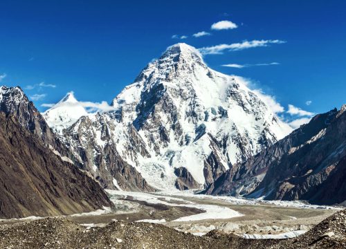
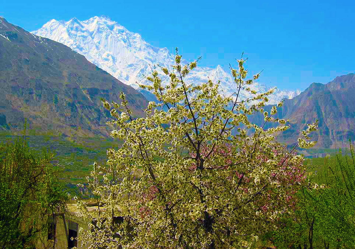
The Karakoram is the backbone of vast colliding mountain ranges incorporating some of the world’s highest peaks and longest non-Polar glaciers. These peaks reach 7,000-8,000m and include K2, the second-highest mountain on Earth.
for the first 10 days we will be using the Karakoram cycling itinerary and it will be further extended as mentioned in the itinerary
Tour Itinerary
Arrive at Islamabad airport. Complementary airport to hotel transfers are included for all flight times. At 6pm you will meet the group and our representative at the hotel for a briefing. Islamabad Altitude: 540 metres (1,770 ft) Accommodation: Hotel
We will try to take the early morning flight to Gilgit (not included in trip cost); this is one of the most dramatic flight routes in the world. A small Fokker Friendship plane flies around Nanga Parbat at 8,125m; the sharp triangle of K-2, the second highest mountain in the world, is clearly visible on the horizon. The pilot sometimes invites passengers into the cockpit to see some of Pakistan’s 82 peaks over 7,000m, which stretch, range after range, as far as the eye can see.
This route is ‘weather dependent’ with about one third of flights cancelled, some at the last moment. If the flight is cancelled we will travel by coach to Gilgit.
On arrival in Gilgit we will be transferred to our hotel.
Gilgit Altitude: 1,500m Overnight at Hotel.
We spend the day relaxing in Gilgit. You have the option of visiting the incredible seventh century Kargah Buddha, a three meter high statute carved half way up a cliff-face. A 10-minute walk from here is the Shuko Gah, a small village where a Buddhist birch bark text (now called the Gilgit manuscripts) was found in 1931. The manuscripts are now divided among museums in London, Rome, Delhi and Karachi. Gilgit Altitude: 1,500m (4921ft Cycle Distance: 18km (11 miles Total Climb: 225m (738ftTotal Descent: 225m. Overnight at Hotel
Today we set off on the bikes and cycle into the beautiful and remote Bagrote Valley which spans a distance of 25km and is 43km from Gilgit. Located at the heart of the Karakorum Mountains, it is surrounded by four Mountain Peaks: Rakapushi to the West, Dirn to the North, Popurash to the East and Dubani to the South East. The Bagrote River flows through the steep valley and merges with the Gilgit. The lower region of the valley has been likened to a lunar landscape and is in strong contrast to the upper valley. We cycle up the narrow road to the summer pastures passing beautiful terraced fields and meadows. The crops and orchards are irrigated by water channels from the Barchi and Hinarchi glaciers and mountain snow. Ice from the glacier is transported to Gilgit as the town has no ice factory. Chirah is the final village along the track, with a view of Hinarche Glacier and a series of ridges culminating in the Diran Peak (7270m). Nagyr is on the other side. Tonight we will be camping. Chirah Altitude: 2,445m (8,022ft) Cycling Distance: 43km Ascent : 1,377m Descent: 372m Overnight at Camping (B,L,D)
This morning we visit the local school and women’s sewing center, a vocational training project; both are supported by redspokes LVCF charity. We have the opportunity to meet families from the community. There is time to walk around and enjoy the view of the prominent Dobani peak and the Hinarche Glacier. We cycle back to Gilgit, mainly downhill; a gentle trip compared with yesterday’s ascent up the valley. Back in Gilgit you will have time to look around, visit a tea shop or pick up some of the handicrafts for sale in the town. Gilgit Altitude: 1,500m Cycle Distance: 43km
Ascent : 372m Descent: 1,377m Overnight at hotel.
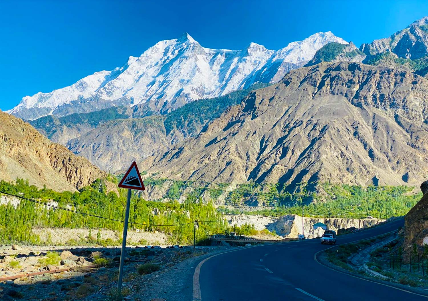
Shortly after leaving Gilgit we rejoin the KKH. The road climbs slowly passing a few small villages, before we start to witness the huge spiral of Rakaposhi looming in the distance. The road goes so close to its base that it is hidden most of the way. It is only when we arrive at our small family guesthouse at Minapin that we really witness the true beauty of Rakaposhi. Our accommodation for the night is situated in a beautiful tranquil orchard. Minapin Altitude: 2,030m Cycle Distance: 82km Ascent : 1,353m Descent: 772m Overnight at Hotel or local traditional Guest House
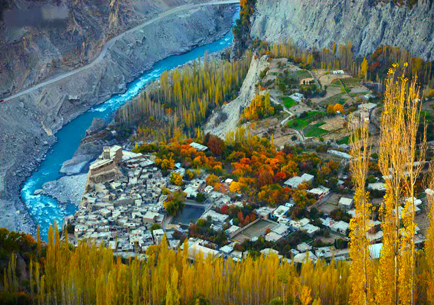
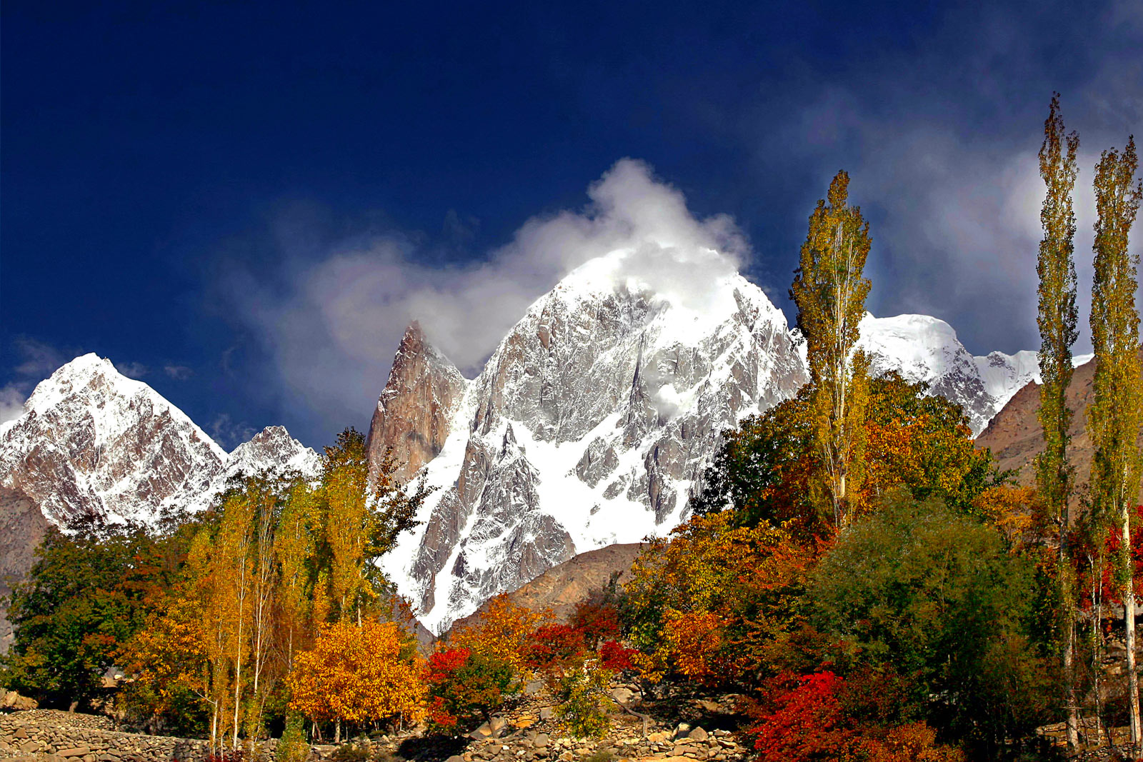
The Karakoram highway (KKH) is at its most spectacular between Ghulmit and Gulmit. The road rides high on the eastern side of the river, twisting and turning around the barren foot of the Hispar Range, which boasts six peaks over 7,000 metres. On the opposite bank, villages cling implausibly to the side of the 7,388m Ultar Mountain. Above, the jagged teeth along the ridge hide the highest snow-covered peaks from view. A short but spectacular day to Karimabad, the capital of Hunza. Karimabad Altitude: 2,400m Cycle Distance: 35km Ascent : 703m Descent: 341m Overnight at Hotel.
A rest day, but with so much to see in this enchanting village, it is unlikely that you will get much rest. Highlights are a visit to the 13th Century Baltit Fort or a visit to see the Sacred Rocks of Hunza. For the really adventuress amongst you a trek up to Hon will give you incredible views across the River the whole of the Nagar valley. Karimabad Altitude: 2,400m Overnight at Hotel.
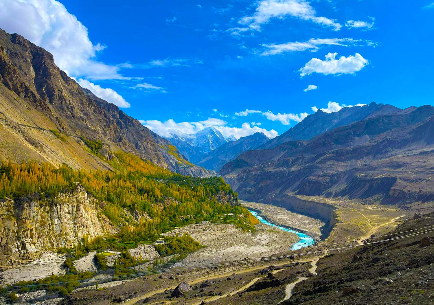
As we leave Karimabad the road drops down to the village of Ganesh before we begin a fairly hard 15 km climb. Remember that if at any time you have had enough, just wait around for the back-up vehicle. Due to the floods of 2010, a section of the KKH between the village of Gulmet, and Gulkin is now impassable and we will take a ferry here to continue along the route. This afternoon we cycle on a further 16 km to Passu. The road climbs with intermittent glimpses of glaciers, precipices and gleaming white peaks, before the 10 km descent to Passu, which brings us directly in front of the incredible Passu Glacier where we will stop for the night. Passu Altitude: 2,480m Cycle Distance: 41km Ascent : 910m Descent: 762m Overnight at Hotel
We can make a late start this morning. When we depart our beautiful surroundings we have a picturesque 39 km cycle ride to the quiet and unremarkable border village of Sust. We can pick up any supplies we need here, before we cross over the border.Cycling Distance: 38km Ascent : 601m Descent: 265m Sust Altitude : 3,668m Overnight at Guest House.
From Sust we will cycle up and then back down part of the remote and tranquil Chaporsun Valley. here you will experience the renowned Wakhi hospitality and culture as we journey through small villages. Our route follows the Gilgit river for most of the day. Cycling Distance: 60km Overnight at Hotel.
We transfer today into China. There are a number of border formalities we will need to pass through during the day. We set off by vehicle driving up to the Khunjerab Pass, taking a brief break at the top to marvel that it was possible to build a road in such an inhospitable environment, before crossing the border and entering a different world, both culturally and geologically. A 1400 year old stone fortress gives the town its name: stone (tash) fortifications (kurgan). Tashkurgan is home to an ethnic Tajik community and marks the halfway point between Europe and China and the town museum. There is also the opportunity to change money and do laundry. Tashkurgan Altitude: 3,085m Overnight At hotel.
Another fantastic day as we cycle to Kala Kule. This is a long and challenging ride with some amazing views in probably the most spectacular part of western China. For the first 40 km there is a gentle incline as the road winds its way through the Tagharma basin, where you get the first views of the stunning north side of the Muztagh Ata Massif (Father of Ice Mountains at 7,546m). The wind can be strong up here but usually it’s a tail wind. The road gets steeper for the last 32km to the top of the 4,200 m pass. Then it’s an exhilarating 30km blast downhill, providing the wind is blowing in the right direction!!! We finish the day with a 20km flat ride to the lake. If we can arrange it we will stay in a Kyrgyz yurt otherwise we will transfer to Kashgar. Cycling Distance: 97km Ascent : 1,114m Descent: 567m Kara Kul Altitude: 3,668mOvernight at Hotel
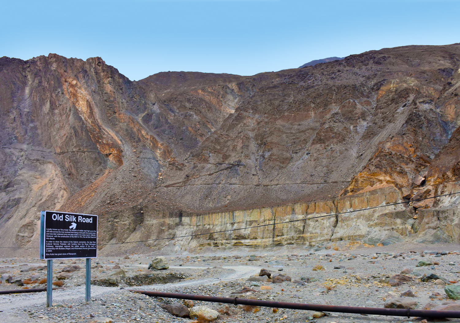
Kashgar was an important hub on the Old Silk Road; a vibrant Islamic center positioned at the foot of the Pamir Mountains and commanding access to the high glacial passes of the Silk Road routes into Central Asia, India and Persia. On Sundays, Kashgar hosts the most famous market in Central Asia, so we will have chance to enjoy a lively, busy scene that defies its geographical remoteness with crowds flocking in to trade knives, hats, carpets, pots and pans, fresh fruit and vegetables, clothes and boots and every kind of domestic and agricultural appliance – often handmade. Colorful and exotic headgear is one of the features of the market. A short distance away is the Ulagh Bazaar, where traders sell their livestock, including horses, camels, cattle and sheep. Be sure to try the street food in the ‘old’ town which bursts into life in the evening.
Kashgar Altitude: 1,282m Overnight at Hotel.
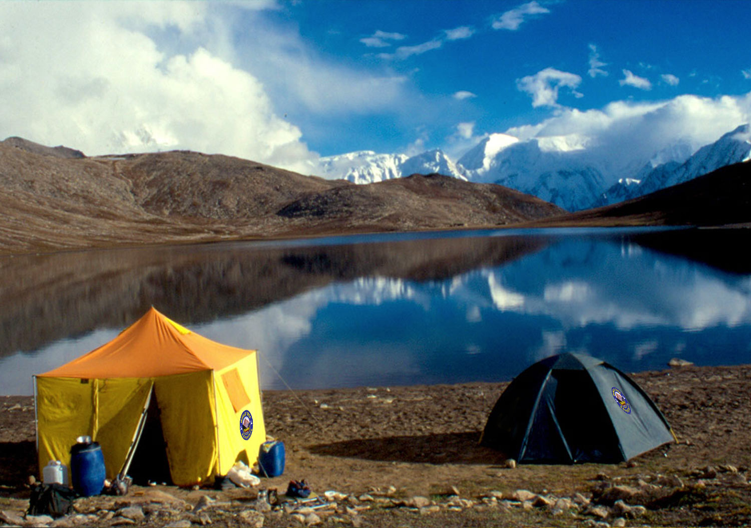
An early start as we transfer across the dramatic Torugart Pass (3,752m) into Kyrgyzstan. A short distance along the road after the visa formalities, we will see the frozen lake Chatyr Kul before reaching Tash – Rabat. This small cluster of yurts is part of a well-developed network of Community Based Tourism (CBT) initiatives which have helped the local economy and gives travellers a great insight into a traditional way of life, unchanged over the centuries. We will be staying tonight in communal yurts. Tash Rabat Altitude: 2,850m. Overnight at Hotel.
Before we leave Tash Rabat we will have a chance to visit the 15th century stone caravanserai. It’s believed to be originally a Nestorian or Buddhist monastery dating back to the tenth century. Setting off on the bikes the lush green pastures and snow-capped mountains of the Tian Shan range are a pleasant change from the red desert on the Chinese side of the border. Our cycling today is over 1000m of descent to reach our destination At Bashy. Cycling Distance: 73km Ascent : 183m Descent: 1,236m Al Bashy Altitude: 2,085m Hotel or Guest house.
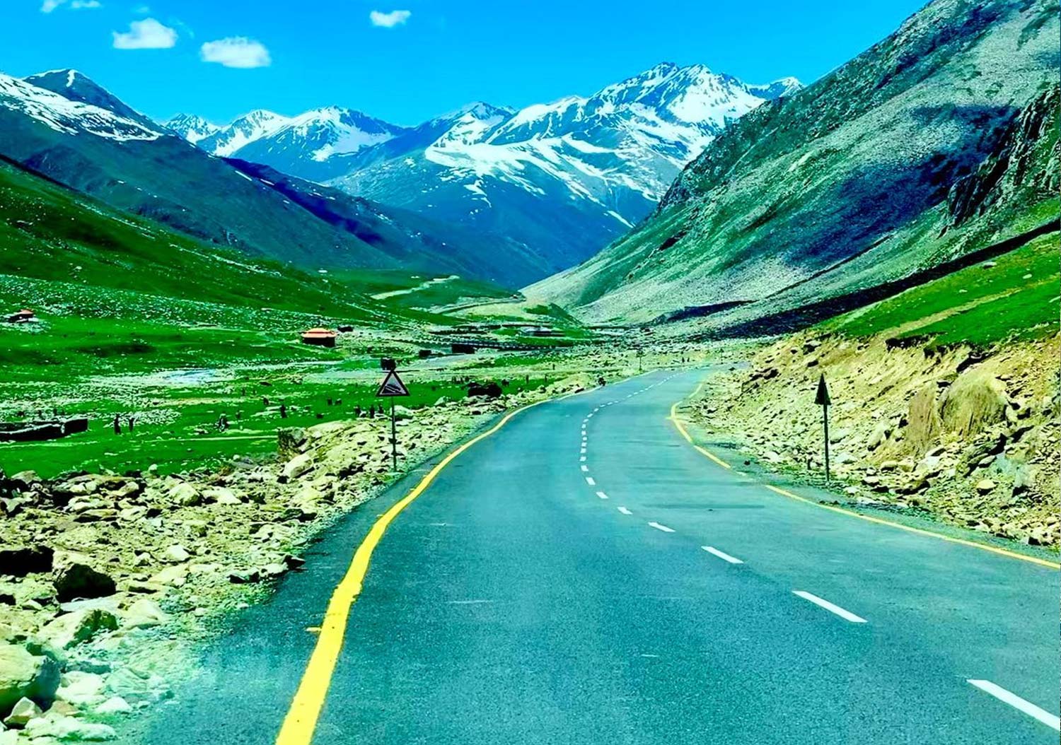
A long day’s cycling. We begin with a relatively easy 27km climb up the Kyzyl Bel Pass (The Red Pass) at 2,625m. Kyrgyzstan is probably the most beautiful of all the Central Asian countries. This is very much in evidence today as we cycle past small farming communities and nomadic shepherds. The road winds between red hills and eroded landscapes, the occasional vehicle will pass by during the 16 km descent towards the town of Naryn our stop for the night. The surface progressively deteriorates to a rutted, bumpy; gravely track making this a thriller ride. Cycling Distance: 46.5km Ascent: 710m Descent: 705m Sleeping Altitude: 2,075m Accommodation: Overnight at Hotel
This is another challenging day as we cycle over the Dolon Pass which at 3,035m is the highest pass we encounter in Kyrgyzstan. The riding begins with an inevitable long climb. Over the peak we will enjoy a long downhill ride through a wide fertile valley that takes us to Kochkor, our stop for the night.
Distance: 119km Ascent: 1,240m Descent: 1,469m. Overnight at Local Guest house or Hotel
Our last day’s cycle on the KKH to Kyrgyzstan tour takes us to Issyk Kul, the world’s second largest alpine lake. Surrounded by the snowcapped Tian Shan Mountains the turquoise waters of the lake never freeze over. A fantastic location to finish a wonderful ride. After lunch we will transfer to Bishkek, pack up our bikes and then spend time exploring this laid-back picturesque city.
Distance: 62km Ascent : 163m Descent: 356m Bishkek Altitude: 724m Overnight at Hotel.
Redspokes KKH – Kyrgyzstan tour ends today. We will arrange your transfer to the airport for your flight home. Bishkek Altitude: 724m